
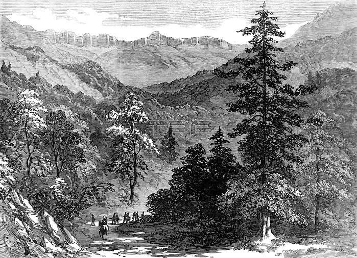
The Abyssinian Expedition: approach to the Abyssinian table-land, from Rayry Guddy, 1868. The British Army in East Africa. A ...view of the Abyssinian table-land, or, rather, of the almost perpendicular wall of rock, or cliff, which forms its eastern boundary, approached through Rayry Guddy, in the Senafe Pass. The situation of Rayry Guddy itself is elevated 6100 ft. above the sea level. It is the first step into the region of pines and fir-trees, which are of two kinds, the juniper-pine of North America and the spruce-fir. A juniper-pine which appears in the foreground of the sketch is 50 ft. or 60 ft. high, and 9 ft. in circumference of its trunk 6 ft. above the ground. From this point the pine-tree becomes more common till it grows most abundantly on the plateau above...The Senafe Pass, as it will henceforth be called, is fifty miles in length. The worst places, where much work is to be done for the improvement of the road, are the defiles of the Upper, Middle, and Lower Sooroo; the pass between the Upper and Lower Rayry Guddy, and the last ascent, coming up to Senafe. From "Illustrated London News", 1868.
| px | px | dpi | = | cm | x | cm | = | MB |
Details
Creative#:
TOP29822377
Source:
達志影像
Authorization Type:
RM
Release Information:
須由TPG 完整授權
Model Release:
no
Property Release:
no
Right to Privacy:
No
Same folder images:
 Loading