
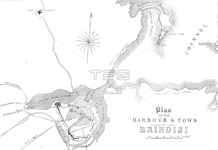
Plan of the harbour and town of Brindisi, [Italy], 1869. The ancient town of Brundusium, which was known to Herodotus in the fifth century before Christ, is supposed to have been founded, very long before, by a colony of Aetolian Greeks. Its name is thought to be derived from a word of their language, meaning "a stags head;" the branching form of the two inner harbours, seen in our Plan, bearing a fancied resemblance to the shape of a stags horns. The port was so good, and had such a commanding position at the mouth of the Adriatic, just opposite the Ionian Isles, that it must have early invited the commerce of maritime nations...Brundusium was conquered by the Romans u.c. 686, and became their chief naval depot when they turned their attention to Eastern conquests. This place...was the terminus of the great road called the Appian Way, which led from Rome through Capua and Beneventum, thence parting into two different routes - one to the left hand, by Canosa and Hannibals battle-field of Cannae, to the coast at Bari; another way to the right hand, by Venosa, the birthplace of Horace. From "Illustrated London News", 1869.
| px | px | dpi | = | cm | x | cm | = | MB |
Details
Creative#:
TOP29822265
Source:
達志影像
Authorization Type:
RM
Release Information:
須由TPG 完整授權
Model Release:
no
Property Release:
no
Right to Privacy:
No
Same folder images:
 Loading