
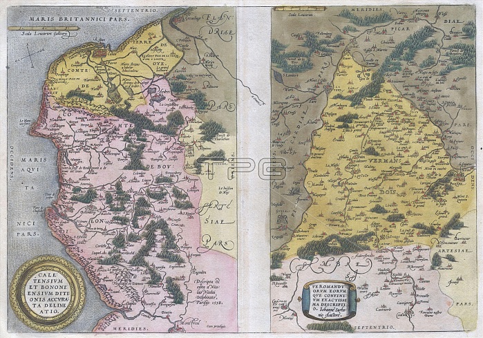
1579, Ortelius Map of Calais and Vermandois, France and Vicinity, Abraham Ortelius, also Orthellius, 1527 ¡V 1598, Flemish, Netherlandish cartographer and geographer
| px | px | dpi | = | cm | x | cm | = | MB |
Details
Creative#:
TOP29782057
Source:
達志影像
Authorization Type:
RM
Release Information:
須由TPG 完整授權
Model Release:
Not Available
Property Release:
Not Available
Right to Privacy:
No
Same folder images:
1579OrteliusMapofCalaisandVermandoisFranceandVicinityAbrahamOrteliusalsoOrthellius1527¡V1598FlemishNetherlandishcartographerandgeographertopographycartographygeographylandillustrationgeographictraveltopochartgridlatitudelongitudegeometricatlasmapvintageancienthistoryworldpaperoldretroeartharthistoricaldecorativenavigationagedhistoricjourneydiscoveryexplorationgeographicalMappamundispaceregionoldmapantiquemaprareoldmapsoldantiqueplanolsantiquemapoldantiqueview
152715791598AbrahamCalaisFlemishFranceMapMappaNetherlandishOrteliusOrteliusOrthelliusVermandoisVicinityagedalsoancientandandandantiqueantiqueantiqueantiqueartatlascartographercartographychartdecorativediscoveryearthexplorationgeographergeographicgeographicalgeographygeometricgridhistorichistoricalhistoryillustrationjourneylandlatitudelongitudemapmapmapmapmapsmundinavigationofoldoldoldoldoldolspaperplanrareregionretrospacetopotopographytravelviewvintageworld¡V
 Loading