
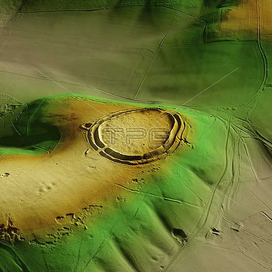
3D LiDAR scan of Barbury Castle in Wiltshire, UK. The digital terrain model offers a view of the surrounding landscape without obstruction from foliage. This ancient hillfort dates back to the Iron Age, roughly 2500 years ago. It is believed to have been occupied and used for defensive purposes. Image contains UK public sector information licensed under the Open Government Licence v3.0.
| px | px | dpi | = | cm | x | cm | = | MB |
Details
Creative#:
TOP29741227
Source:
達志影像
Authorization Type:
RM
Release Information:
須由TPG 完整授權
Model Release:
N/A
Property Release:
N/A
Right to Privacy:
No
Same folder images:
3daltimeterancientarchaeologicalarchaeologyarcheologicalarcheologybarburycastlebritainbritishculturalculturedigitalterrainmodeldtmelevationenglandenglisheuropeeuropeanhillforthillfortshillforthillfortshistoricalhistoryironagelandscapelaserlidarlightdetectionandrangingmodelmodelingmodellingmonumentno-onenobodyprehistoricprehistoryscanscheduledterrainthreedimensionaltopographicaltopographyukunitedkingdomwiltshire
3dagealtimeterancientandarchaeologicalarchaeologyarcheologicalarcheologybarburybritainbritishcastleculturalculturedetectiondigitaldimensionaldtmelevationenglandenglisheuropeeuropeanfortfortshillhillhillforthillfortshistoricalhistoryironkingdomlandscapelaserlidarlightmodelmodelmodelingmodellingmonumentno-onenobodyprehistoricprehistoryrangingscanscheduledterrainterrainthreetopographicaltopographyukunitedwiltshire
 Loading