
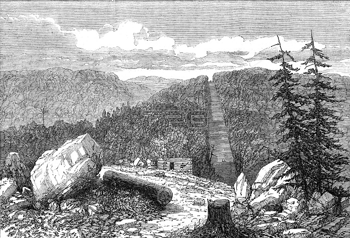
The boundary line between the United States and Canada, 1861. Our Illustration represents a portion of the boundary line where it crosses the Grand Trunk Railway or rather that branch of it which connects the Atlantic port of Portland, in the State of Maine, with the line between Montreal and Quebec. The boundary line is straight at this point, but afterwards becomes exceeding crooked, following the courses of streamlets and a portion of the River St. John. Where the line passes through the wildernesses the trees have been cut down so as to leave an open avenue - stone posts being set up at intervals. A short distance north, on the Canadian side of this line, are situated good towns and villages, being the eastern townships of Canada. Between them and the United States there exists no physical barrier: we may, therefore, assume that in the event of war it is upon this portion of the colony that the first blow will fall. From "Illustrated London News", 1861.
| px | px | dpi | = | cm | x | cm | = | MB |
Details
Creative#:
TOP29535738
Source:
達志影像
Authorization Type:
RM
Release Information:
須由TPG 完整授權
Model Release:
Not Available
Property Release:
Not Available
Right to Privacy:
No
Same folder images:
 Loading