
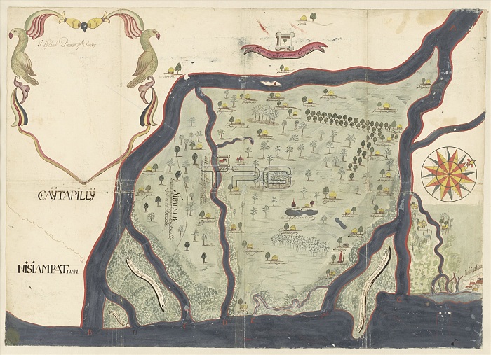
Map of the island of Dieuw or DieWij on the Coromandel coast, India, 1675-1725. Creator: Anon.
| px | px | dpi | = | cm | x | cm | = | MB |
Details
Creative#:
TOP29406597
Source:
達志影像
Authorization Type:
RM
Release Information:
須由TPG 完整授權
Model Release:
Not Required
Property Release:
Not Required
Right to Privacy:
No
Same folder images:
EuropeIndiaAsiahistoricalartsmapartislandmuseumNetherlandsDutchcolorscenedeltadepictionlocationcenturydrawinggalleryinkcartographyconceptexhibitionexhibitwatercolourgouacheillustrated17thcenturyartgalleryColourNetherlandish18thcenturyEighteenthCenturyculturehistoryhistoricseventeenthcenturymap-makingRijksmuseumTGNCoromandelCoastillustrationinkmapMapmakingAnonAnonymouswatercolouronpaperartcentrepaperHeritageArtLowCountriesgouache(paint)watercolour(paint)paperDieuwDieuwijk
(paint)(paint)17th18thAnonAnonymousArtAsiaCenturyCoastColourCoromandelCountriesDieuwDieuwijkDutchEighteenthEuropeHeritageIndiaLowMapmakingNetherlandishNetherlandsRijksmuseumTGNartartartartscartographycentrecenturycenturycenturycenturycolorconceptculturedeltadepictiondrawingexhibitexhibitiongallerygallerygouachegouachehistorichistoricalhistoryillustratedillustrationinkinkislandlocationmapmapmap-makingmuseumonpaperpaperpapersceneseventeenthwatercolourwatercolourwatercolour
 Loading