
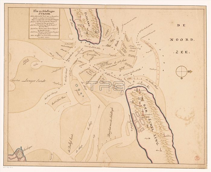
Map of Vlieland, Terschelling and the surrounding sandbanks, 1708 or later. Creator: Isaak de Graaf.
| px | px | dpi | = | cm | x | cm | = | MB |
Details
Creative#:
TOP29405940
Source:
達志影像
Authorization Type:
RM
Release Information:
須由TPG 完整授權
Model Release:
Not Required
Property Release:
Not Required
Right to Privacy:
No
Same folder images:
natureEuroperiverriversseacoastartscoastalislandscoastlineartislandmuseumgeographyNetherlandsDutchcolorlocationcenturydrawingchannelssepiacartographyNorthSeawatercolourdikedykeDykesColour18thcenturydikesEighteenthCenturygeographicalfeaturemap-makingRijksmuseumTGNinkmapMapmakingflooddefenceFrieslandTerschellingpaperHeritageArtDrawingLowCountrieswatercolour(paint)VlielandIsaakdeGraafGraafIsaakdeIsaacdeGraafGraafIsaacdeNicolaesCornelisz.WitsenWitsenNicolaesCornelisz.WitsenNicolaesNicolaesWitsen
(paint)18thArtCenturyColourCornelisz.Cornelisz.CountriesDrawingDutchDykesEighteenthEuropeFrieslandGraafGraafGraafGraafHeritageIsaacIsaacIsaakIsaakLowMapmakingNetherlandsNicolaesNicolaesNicolaesNicolaesNorthRijksmuseumSeaTGNTerschellingVlielandWitsenWitsenWitsenWitsenartartscartographycenturycenturychannelscoastcoastalcoastlinecolordededededefencedikedikesdrawingdykefeaturefloodgeographicalgeographyinkislandislandslocationmapmap-makingmuseumnaturepaperriverriversseasepiawatercolourwatercolour
 Loading