
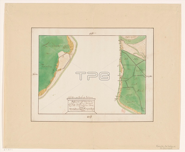
Map of Den Helder and part of Texel with the intervening Marsdiep, in or after 1688. Creator: Anon.
| px | px | dpi | = | cm | x | cm | = | MB |
Details
Creative#:
TOP29405655
Source:
達志影像
Authorization Type:
RM
Release Information:
須由TPG 完整授權
Model Release:
Not Required
Property Release:
Not Required
Right to Privacy:
No
Same folder images:
EuropehistoricalartsmapartmuseumgeographyNetherlandsDutchcolorscalelocationcenturydrawingmeasurementconceptmeasurements17thcenturyColourhistoryhistoricseventeenthcenturygeographicalfeatureNorthHollandRijksmuseumTGNTexelinkAnonAnonymousIsaacDenHelderpaperHeritageArtDrawingAdriaenvanLowCountriesscaledrawingwatercolour(paint)MarsdiepIsaacHaringhuysenHaringhuysenAdriaenvanTwuijverTwuijverAbramBleuseBleuseAbram
(paint)17thAbramAbramAdriaenAdriaenAnonAnonymousArtBleuseBleuseColourCountriesDenDrawingDutchEuropeHaringhuysenHaringhuysenHelderHeritageHollandIsaacIsaacLowMarsdiepNetherlandsNorthRijksmuseumTGNTexelTwuijverTwuijverartartscenturycenturycenturycolorconceptdrawingdrawingfeaturegeographicalgeographyhistorichistoricalhistoryinklocationmapmeasurementmeasurementsmuseumpaperscalescaleseventeenthvanvanwatercolour
 Loading