
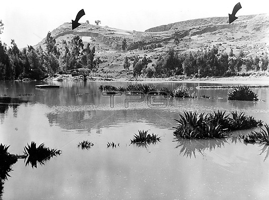
Lake formed from melted ice from an avalanche from Peru's highest mountain Mount Huascaran caused by the 1970 Ancash earthquake. The arrows point to piles of debris that are up to 15 metres high. The earthquake, also known as the Great Peruvian earthquake, struck 35 kilometres off the coast of Peru on the afternoon of the 31st May 1970. The earthquake had a magnitude of 7.9 and triggered a number of landslides, including the avalanche from Mount Huascaran. It was the worst natural disaster in Peru's history, causing widespread destruction and killing approximately 70,000 people and injuring a further 150,000. Photographed east of the Rio Santa at Recuay, in June or July 1970.
| px | px | dpi | = | cm | x | cm | = | MB |
Details
Creative#:
TOP28966571
Source:
達志影像
Authorization Type:
RM
Release Information:
須由TPG 完整授權
Model Release:
n/a
Property Release:
n/a
Right to Privacy:
No
Same folder images:
 Loading