
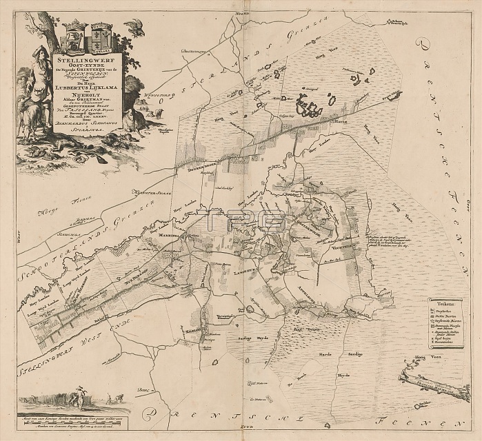
Map of the Ooststellingwerf district, Stellingwerf Oost-eynde the ninth district of the Sevenwolden (...) (title on object), Top left cartouche with title and administrative information about the district. The cartouche is surrounded by a hunter, hunting dogs, cattle and the coats of arms of Ooststellingwerf and of the local landowner Lubbertus Lycklama a Nijeholt. Bottom left a scaled map: Maat van 1200 konings roeden maakende een uire gaans welker 2000 maaken een gemeene Duytze myl van 15 in een graad. Above that farmers. Bottom right legend. print maker: Caspar Luyken, (attributed to), Bernardus Schotanus a Sterringa, (mentioned on object), publisher: Francois Halma, (mentioned on object), print maker: Amsterdam, Friesland, publisher: Leeuwarden, 1698 and/or 1718, paper, engraving, etching, height 487 mm x width 530 mm.
| px | px | dpi | = | cm | x | cm | = | MB |
Details
Creative#:
TOP28938074
Source:
達志影像
Authorization Type:
RM
Release Information:
須由TPG 完整授權
Model Release:
No
Property Release:
No
Right to Privacy:
No
Same folder images:
 Loading