
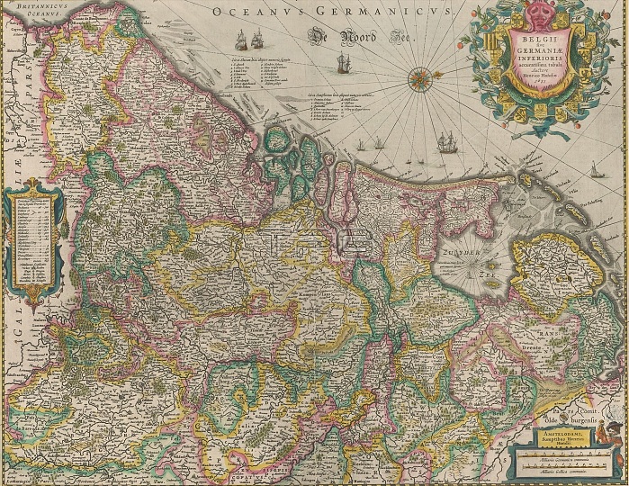
Map of the Netherlands, 1631, Belgii sive Germaniae inferioris accuratissima tabula (title on object), On the left a cartouche containing an outline with topographical information about each province. Top right title cartouche in the form of a shield surrounded by the arms of the Seventeen Provinces. Bottom right cartouche with scale bar: Milliaria Germanica communia, Milliaria Gallica communia. Degrees along the edges. Orientation: north right. On verso French text. print maker: Henricus Hondius, (mentioned on object), publisher: Henricus Hondius, (mentioned on object), Amsterdam, 1631, paper, engraving, letterpress printing, height 403 mm x width 505 mm.
| px | px | dpi | = | cm | x | cm | = | MB |
Details
Creative#:
TOP28937997
Source:
達志影像
Authorization Type:
RM
Release Information:
須由TPG 完整授權
Model Release:
No
Property Release:
No
Right to Privacy:
No
Same folder images:
 Loading