
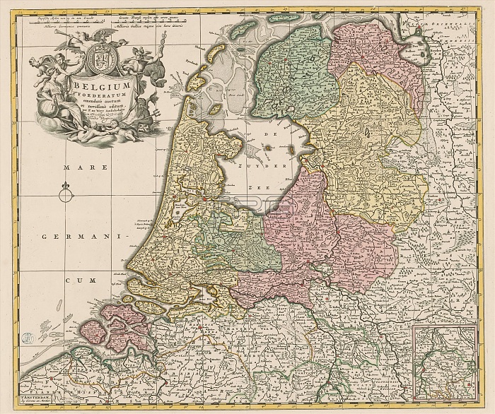
Map of the Republic of the Seven United Netherlands, Belgium Foederatum (...) (title on object), Top left cartouche with title and the coat of arms of the Republic, around which various figures are depicted: Urania, Fama, Mercury, Neptune and several putti. Bottom right an inset map of part of present-day Limburg (part that belonged to State Brabant at the time). Scale bar top left: Duytsche mylen of 15 in a graadt / Milliaria Germanica communia, Groote Franse mylen ofte hours gaans / Milliaria Gallica magna sive hore itineris. The map is provided with a coordinate net and a degree division along the edges. print maker: Frederik de Wit, (mentioned on object), publisher: Covens & Mortier, (mentioned on object), Staten van Holland en West-Friesland, (mentioned on object), Amsterdam, c. 1670 and/or after 1710, paper, engraving, height 479 mm x width 557 mm.
| px | px | dpi | = | cm | x | cm | = | MB |
Details
Creative#:
TOP28937971
Source:
達志影像
Authorization Type:
RM
Release Information:
須由TPG 完整授權
Model Release:
No
Property Release:
No
Right to Privacy:
No
Same folder images:
 Loading