
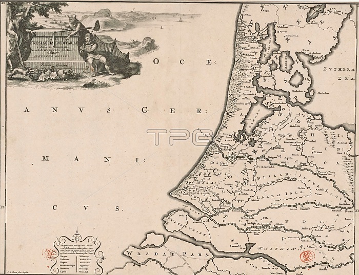
Historical map of the Netherlands with the areas of the Batavians and Frisians, Pars II Fresiae haereditariae (...) (title on object), Map of the Frisian areas in western Netherlands in Roman times. Top left cartouche with title, surrounded by a hunter, a farmer and a fisherman. Scale stick below cartouche: Triens gradus. Bottom left a cartouche with a number of ancient places not depicted on the map because their exact location could no longer be determined. Degrees along left and right edges. print maker: Gerrit de Broen (I), (mentioned on object), Menso Alting, (mentioned on object), Amsterdam, 1697 - 1700 and/or 1725, paper, engraving, etching, height 317 mm x width 417 mm.
| px | px | dpi | = | cm | x | cm | = | MB |
Details
Creative#:
TOP28937949
Source:
達志影像
Authorization Type:
RM
Release Information:
須由TPG 完整授權
Model Release:
No
Property Release:
No
Right to Privacy:
No
Same folder images:
 Loading