
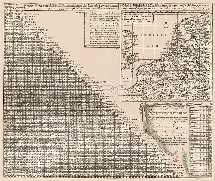
Map of the Seventeen Provinces with distance table, De groote Nederlandse stedenwyzer (...) / La grande echelle des Pais-Bas (...) (title on object), On the left a distance table showing how many walking hours 108 important cities of the Seventeen Provinces are away from each other. To the right is a map of the Seventeen Provinces, provided with a search grid, a degree scale along the edges and at the bottom left a scale bar: Gemeene Duytsche mylen and Fransche mylen or hours gaans. To the left of the map is a use of the distance table. Below the map is a distance table with explanation showing the number of walking hours between various foreign cities and Amsterdam, The Hague, Rotterdam and Utrecht. print maker: Jan de Lat, (possibly), after design by: Jan de Lat, (mentioned on object), publisher: Jan de Lat, (mentioned on object), Deventer, 1731 - 1740, paper, engraving, height 464 mm x width 550 mm.
| px | px | dpi | = | cm | x | cm | = | MB |
Details
Creative#:
TOP28937940
Source:
達志影像
Authorization Type:
RM
Release Information:
須由TPG 完整授權
Model Release:
No
Property Release:
No
Right to Privacy:
No
Same folder images:
 Loading