
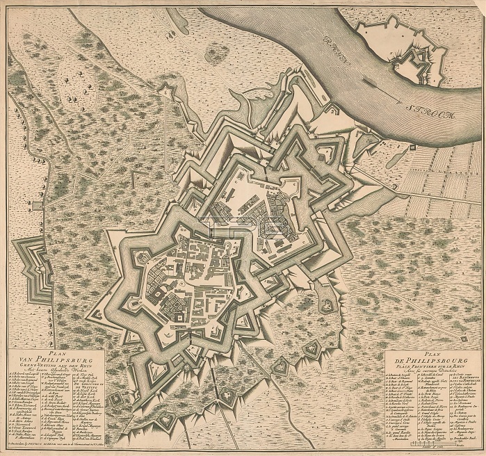
Map of Philippsburg, Plan van Philipsburg grens-vesting aan den Rhyn / Plan de Philipsbourg place frontiere sur le Rhin (title on object), print maker: anonymous, publisher: Pieter Schenk (II), (mentioned on object), Amsterdam, 1727 - 1738, paper, etching, engraving, height 538 mm x width 579 mm.
| px | px | dpi | = | cm | x | cm | = | MB |
Details
Creative#:
TOP28937928
Source:
達志影像
Authorization Type:
RM
Release Information:
須由TPG 完整授權
Model Release:
No
Property Release:
No
Right to Privacy:
No
Same folder images:
 Loading