
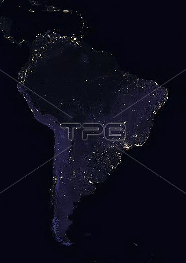
Colour satellite image of South America at night. This image in Lambert Azimuthal Equal Area projection was compiled from data acquired in 2016 by Landsat satellites.
| px | px | dpi | = | cm | x | cm | = | MB |
Details
Creative#:
TOP28927051
Source:
達志影像
Authorization Type:
RM
Release Information:
須由TPG 完整授權
Model Release:
n/a
Property Release:
n/a
Right to Privacy:
No
Same folder images:
01-02-2016AerialviewCartographynobodyno-oneSatelliteviewsatelliteimagefromspaceSouthAmericaContinentNightLatinAmericaBrazilForestRainforestAmazonregionAmazonriverAndesMountainArgentinaBoliviaBrazilChileColombiaEcuadorGuyanaParaguayPeruSurinameUruguayVenezuelaFrenchGuianaCaribbeannightlitupilluminatedSouthAmerica
01-02-2016AerialAmazonAmazonAmericaAmericaAmericaAndesArgentinaBoliviaBrazilBrazilCaribbeanCartographyChileColombiaContinentEcuadorForestFrenchGuianaGuyanaLatinMountainNightParaguayPeruRainforestSatelliteSouthSouthSurinameUruguayVenezuelafromilluminatedimagelitnightno-onenobodyregionriversatellitespaceupviewview
 Loading