
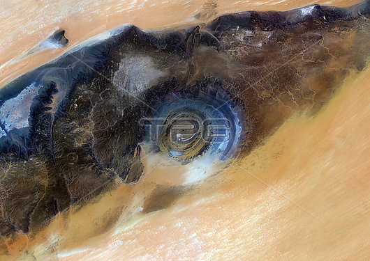
Colour satellite image of the Richat structure, Mauritania. This is a geological formation in the Maur Adrar Desert in the African country of Mauritania. Although it resembles an impact crater, the Richat structure formed when a volcanic dome hardened and gradually eroded, exposing the onion-like layers of rock. This image was compiled from data acquired by Sentinel-2 and Landsat 8 satellites.
| px | px | dpi | = | cm | x | cm | = | MB |
Details
Creative#:
TOP28926769
Source:
達志影像
Authorization Type:
RM
Release Information:
須由TPG 完整授權
Model Release:
n/a
Property Release:
n/a
Right to Privacy:
No
Same folder images:
 Loading