
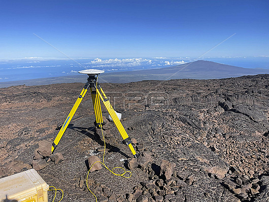
GPS survey station, Mauna Loa, Hawaii, USA. Here, GPS is being used as a tool to monitor volcanic activity. The movement of magma beneath the surface of a volcano can change the shape of the ground. Magma moving near the surface of a volcano causes the ground above it to shift upwards. GPS is able to measure these changes, making it a useful tool to help predict eruptions.
| px | px | dpi | = | cm | x | cm | = | MB |
Details
Creative#:
TOP28926747
Source:
達志影像
Authorization Type:
RM
Release Information:
須由TPG 完整授權
Model Release:
n/a
Property Release:
n/a
Right to Privacy:
No
Same folder images:
 Loading