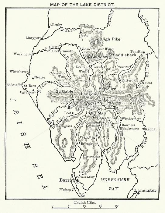
7160437 Map of the Lake District (litho) by English School, (20th century); Private Collection; (add.info.: Map of the Lake District. Illustration for Collins??Wide World Geography Reader, The British Isles (Collins, c 1910).); 穢 Look and Learn.
| px | px | dpi | = | cm | x | cm | = | MB |
Details
Creative#:
TOP28701378
Source:
達志影像
Authorization Type:
RM
Release Information:
須由TPG 完整授權
Model Release:
no
Property Release:
no
Right to Privacy:
No
Same folder images:
20thcentury20centuryXXcenturyXXthcenturytwentiethcenturyc20th2020thxxxxthtwentiethcentury2020thxxxxthcentury2020th20thXXXXth20thcentury20thearlytwentiethcenturymid-20thcentury1900s1900\'s1900-19091900-1909years0000s1900-1910years0000s1910s10s1910\'s1910-19191910-1919years1010syears1910-years10-yearsten1900-1910years1010sUnitedKingdombritishBritainGBUKU.KBritainBritishGreatBritain-Britishbritisch-britischUnitedKngdomBritBritonsGreatBritainEuropeeuropeanhistoryhistorichistoricalmapmapsblackandwhiteblackandwhitelithographlithographychromolithographlithosLakeDistrictTheLakeDistrictEnglandenglishEnaglandEngishEnglandEnglishEnglishEnglishCumbriaillustrationillustrations
----000000s00s10101010s10s10s1900-19091900-19091900-19101900-19101900\'s1900s1910-19191910\'s1910s2020202019101910-191920th20th20th20th20th20th20thBritBritainBritainBritainBritainBritishBritishBritonsCumbriaDistrictDistrictEnaglandEngishEnglandEnglandEnglishEnglishEnglishEuropeGBGreatGreatKingdomKngdomLakeLakeTheU.KUKUnitedUnitedXXXXXXthXXthandblackblackandwhitebritischbritischbritishc20thcenturycenturycenturycenturycenturycenturycenturycenturycenturycenturychromolithographearlyenglisheuropeanhistorichistoricalhistoryillustrationillustrationslithographlithographylithosmapmapsmid-20thtentwentiethtwentiethtwentiethwhitexxxxxxthxxthyearsyearsyearsyearsyearsyearsyears

 Loading