
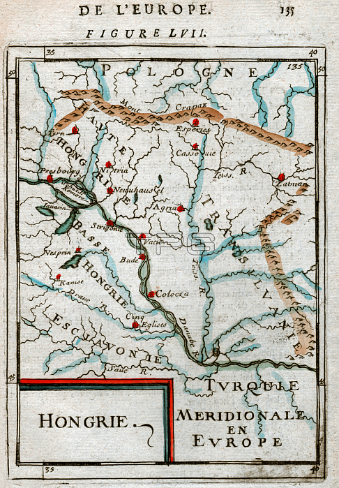
7143243 Map of Hungary 1683 by Mallet, Alain Manesson (1630-1706); Private Collection; (add.info.: Geography. Map of Hungary and Transylvania, at the south the Balkans are mentionned as Turkey. Engraving in: Description de l???nivers, by Alain Manesson Mallet, France, 1683.); Photo 穢 CCI.
| px | px | dpi | = | cm | x | cm | = | MB |
Details
Creative#:
TOP28688809
Source:
達志影像
Authorization Type:
RM
Release Information:
須由TPG 完整授權
Model Release:
no
Property Release:
no
Right to Privacy:
No
Same folder images:
17thcentury17centuryXVIIcenturyXVIIthcenturyseventeenthcenturyc17th1717thxviixviithcenturyBalkansgeographicalmapcartographygeographyottomanempireottomanengravingengraverTurkeyturkturkishEuropeeuropeanEuropenEuropemapMiddleEastHungaryhungarianhungarianhungarianhungarianHungaryHungarianeuropeanunionEURomaniaroumaniamzengraving
171717th17thBalkansEUEastEuropeEuropeEuropenHungarianHungaryHungaryMiddleRomaniaTurkeyXVIIXVIIthc17thcartographycenturycenturycenturycenturycenturycenturyempireengraverengravingeuropeaneuropeangeographicalgeographyhungarianhungarianhungarianhungarianmapmapmzengravingottomanottomanroumaniaseventeenthturkturkishunionxviixviith
 Loading