
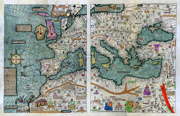
G閛graphes; Cartographes & G閛graphie / 14e si鑓leCresques; Abraham (1325-1387)Partie occidentale de "l'Atlas Catalan de 1375" (Mapamondi) montrant des terres bien connues ?l'閜oque : l'Europe; l'Afrique du Nord et sub-saharienne; le bassin m閐iterran閑n et la Terre Sainte.(L'Atlas catalan est un portulan du 14e si鑓le; r閍lis?vers 1375 et traditionnellement attribu閑 ?Abraham Cresques; un cartographe juif majorquin de Palma; et ?son fils Jehuda Cresques).Fac-simil?de l'original.Washington; The Library of Congress.
| px | px | dpi | = | cm | x | cm | = | MB |
Details
Creative#:
TOP28417623
Source:
達志影像
Authorization Type:
RM
Release Information:
須由TPG 完整授權
Model Release:
No
Property Release:
No
Right to Privacy:
No
Same folder images:
 Loading