
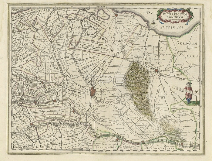
Map of the province of Utrecht; Vltraiectvm Dominivm (title on object); Map of the province of Utrecht on a scale of 1: 150 000 with the north on the right. Top right a cartouche with the title. Right: a standing surveyor with a distance bar in his hand that indicates a scale in Dutch miles; maps of separate countries or regions; Eemland; Willem Janszoon Blaeu (mentioned on object); 1630; paper; engraving; h 387 mm x w 505 mm
| px | px | dpi | = | cm | x | cm | = | MB |
Details
Creative#:
TOP28295378
Source:
達志影像
Authorization Type:
RM
Release Information:
須由TPG 完整授權
Model Release:
No
Property Release:
No
Right to Privacy:
No
Same folder images:
 Loading