
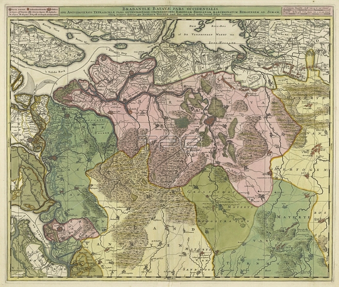
Map of Brabant; Brabantiae Batavae pars occidentalis; sive Antverpiensis tetrarchiae pars septentrionalis comprehendens Baroniam Bredanam; Marchionatum Bergensem ad Zomam ... (title on object); Map of the western part of Brabant. Area between Bergen op Zoom in the west to Tilburg in the east; centrally the Baronie van Breda. Above a strip with on the left a legend of symbols; in the middle the title and on the right two scale sticks: 1 1/2 Common Duytsche Myle of 15 in a Degree / 2 Fransche Mylen or of Hours Gaans of 20 in a Degree. The map is provided with a coordinate grid and a degree distribution along the edges; maps of separate countries or regions; Brabant; Baronie van Breda; anonymous; Amsterdam; 1677 - 1720; paper; engraving; h 500 mm x w 590 mm
| px | px | dpi | = | cm | x | cm | = | MB |
Details
Creative#:
TOP28295374
Source:
達志影像
Authorization Type:
RM
Release Information:
須由TPG 完整授權
Model Release:
No
Property Release:
No
Right to Privacy:
No
Same folder images:
 Loading