
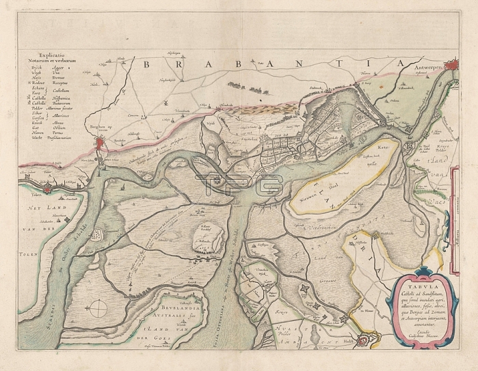
Map of the surroundings of Zandvliet; Tabvla Castelli ad Sandflitam; in terms of simul inundati agri; alluviones; fo哝; alvei; quae Bergas ad Zomam and Antverpiam interjacent; annotantur (title on object); the North on the left; the borders colored; cities; buildings and flags indicated; the roads sometimes populated. Top left explanation of the symbols on the map; center right scale in country miles. Verso: two pages of text; maps of separate countries or regions; Zandvliet; Antwerp; Bergen op Zoom; Willem Janszoon Blaeu; Amsterdam; 1642; paper; watercolor (paint); engraving; h 38.5 cm x w 50.5 cm
| px | px | dpi | = | cm | x | cm | = | MB |
Details
Creative#:
TOP28295369
Source:
達志影像
Authorization Type:
RM
Release Information:
須由TPG 完整授權
Model Release:
No
Property Release:
No
Right to Privacy:
No
Same folder images:
 Loading