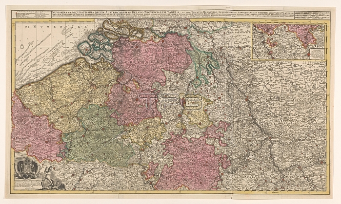
Map of the Southern (Austrian) Netherlands; Novissima et accuratissima decem Austriacarum in Belgio provinciarum tabula; ut sunt ducatus Brabantiae; Luxembergensis; Limburgensis; et Geldriae; comitatus Flandriae (title on object); Map of the Southern (Austrian) Netherlands. Map at the top right of the Duchy of Luxembourg; above that scale in German; Spanish and English-French miles. Top left 'Explanation of signs in this map'. Bottom left assignment to Emperor Charles VI with his weapon and a putto fighting a harpy; maps of separate countries or regions; Southern Netherlands; Charles VI (Holy Roman Emperor); Joachim Ottens (mentioned on object); Amsterdam; 1719; paper; watercolor (paint); engraving; h 48.9 cm x w 85.3 cm
| px | px | dpi | = | cm | x | cm | = | MB |
Details
Creative#:
TOP28295366
Source:
達志影像
Authorization Type:
RM
Release Information:
須由TPG 完整授權
Model Release:
No
Property Release:
No
Right to Privacy:
No
Same folder images:

 Loading