
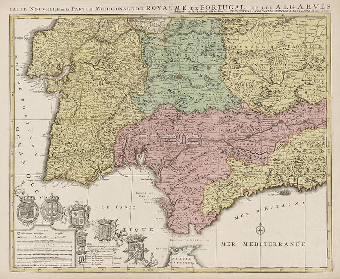
Map of the south of Spain and Portugal; Map with a part of Portugal and the Spanish south coast. Part (bottom left) of a large map of Spain and Portugal in four sheets; ca. 1703. Bottom left the legend and the arms of Spain and Portugal; connected with the arms of the Algarve (including the city arms of Toledo and Grenada); Andalusia and Castile and Le髇; maps of separate countries or regions; flag; colors (as symbol of the state; etc.); Spain; Portugal; Jan Luyken (possibly); Amsterdam; 1720 - 1772; paper; etching; h 503 mm x w 600 mm
| px | px | dpi | = | cm | x | cm | = | MB |
Details
Creative#:
TOP28287168
Source:
達志影像
Authorization Type:
RM
Release Information:
須由TPG 完整授權
Model Release:
No
Property Release:
No
Right to Privacy:
No
Same folder images:
 Loading