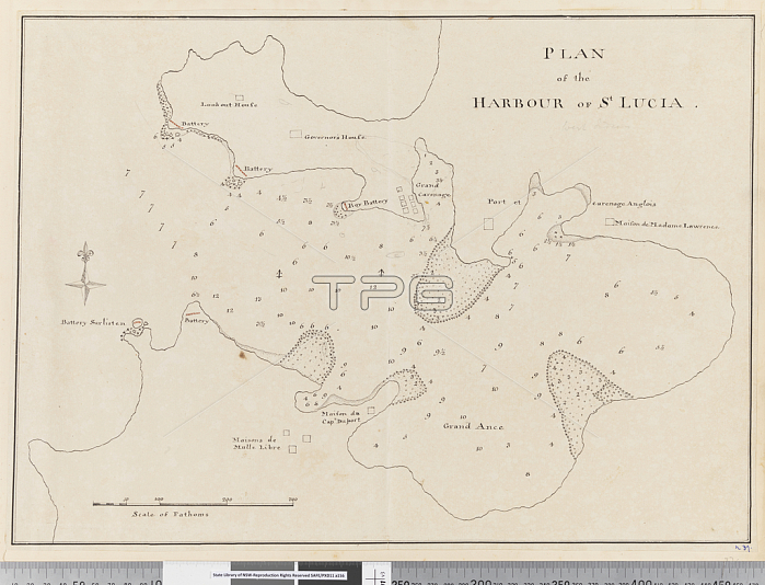
5670304 Page 37c Plan of the harbour of St. Lucia by Unknown artist, (18th century); Mitchell Library, State Library of New South Wales; (add.info.: Original Sketches, Drawings, Maps etc Collected by Admiral Isaac Smith / drawings and watercolours, mainly of Captain Cooks Second Voyage (1772-1775) by William Hodges, Henry Roberts etc Dimensions: Album measures 49 x 70 cm); Mitchell Library, State Library of New South Wales.
| px | px | dpi | = | cm | x | cm | = | MB |
Details
Creative#:
TOP27762910
Source:
達志影像
Authorization Type:
RM
Release Information:
須由TPG 完整授權
Model Release:
No
Property Release:
No
Right to Privacy:
No
Same folder images:
18thcenturyXVIIIthcenturyXVIIIC18theighteenthcenturysecoloXVIII1818thxviiixviiithcentury1818th18th18th18th18thcentury1818th18th18thXVIII18thcenturyEarly18thCenturyAustraliaaustralianaustraliansSouthAustraliaWestAustralianOceaniacoastcoastlineshorelinecoastalseamaritimeNewSouthWalesdrawingmapcartographycoastlineshorelinelabellabellednumberskeycompassscale18thcenturycartographicsurveySurveyingmappingplangeographygeographicalCaribbeanlesserantillesexpeditionexplorationmapcartographycoastlineshorelinelabellabellednumberskeycompassscale18thcenturyc18thcoastcartographicsurveySurveyingmappingplangeographygeographicalCaribbeanlesserantillesexpeditionexploration
18181818th18th18th18th18th18th18th18th18th18th18th18th18th18thAustraliaAustraliaAustralianC18thCaribbeanCaribbeanCenturyEarlyNewOceaniaSouthSouthSurveyingSurveyingWalesWestXVIIIXVIIIXVIIIXVIIIthantillesantillesaustralianaustraliansc18thcartographiccartographiccartographycartographycenturycenturycenturycenturycenturycenturycenturycenturycoastcoastcoastalcoastlinecoastlinecoastlinecompasscompassdrawingeighteenthexpeditionexpeditionexplorationexplorationgeographicalgeographicalgeographygeographykeykeylabellabellabelledlabelledlesserlessermapmapmappingmappingmaritimenumbersnumbersplanplanscalescaleseasecoloshorelineshorelineshorelinesurveysurveyxviiixviiith

 Loading