
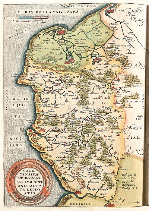
LRI4704334 Map of the Boulonnais territory , Artois and French Flanders (France), 1570 (engraving) by Ortelius, Abraham (1527-98); Museo Navale di Pegli, Genoa, Italy; (add.info.: Caletensium et Bononiensium Ditionis Accurata Delineatio Geography map of the Boulonnais territory (Comte de Boulogne), Artois and French Flanders (France) including the places of Calais, Arches, Greuelinge, Etaples and Montreuil... taken from ???heatrum Orbis Terrarum??by Abraham Ortelius (Oertel, Tell or Ortel, 1527-1598), 1570. Genova, Museo Navale); Luisa Ricciarini.
| px | px | dpi | = | cm | x | cm | = | MB |
Details
Creative#:
TOP27699011
Source:
達志影像
Authorization Type:
RM
Release Information:
須由TPG 完整授權
Model Release:
No
Property Release:
No
Right to Privacy:
No
Same folder images:
 Loading