
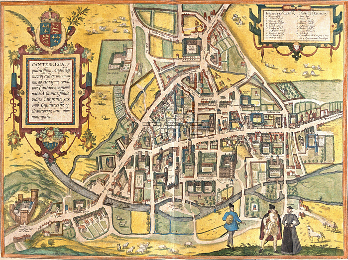
LRI4708624 Map of Cambridge (Cantebrigia), England (etching, 1572-1617) by Hogenberg, Franz (1540-c.1590); Private Collection; (add.info.: Map of Cambridge (Cantebrigia), England - Strong water extracted from Civitates Orbis Terrarum (Atlas of World Cities) by Georg Braun (1541-1622) and Franz Hogenberg (1540-1590), published from 1572 to 1617 - Cambridge, England - From ??????Civitates Orbis Terrarum??by G. Braun and F. Hogenberg, 1572-1617 17); Luisa Ricciarini.
| px | px | dpi | = | cm | x | cm | = | MB |
Details
Creative#:
TOP27697912
Source:
達志影像
Authorization Type:
RM
Release Information:
須由TPG 完整授權
Model Release:
No
Property Release:
No
Right to Privacy:
No
Same folder images:
 Loading