
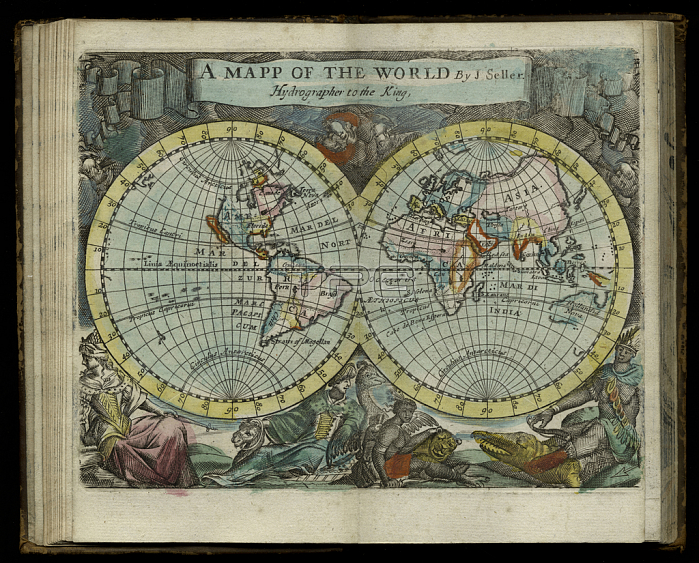
1765722 A map of the world from Atlas maritimus by John Seller, 1682 (hand coloured engraving) by Seller, John (1632-97); 12x14 cm; New York Public Library, USA; (add.info.: Atlas maritimus or A sea-atlas describing the sea-coasts in most of the known parts of the world. Seller was Hydrographer to the King and responsible for the first English maps known as pilots); English, out of copyright.
| px | px | dpi | = | cm | x | cm | = | MB |
Details
Creative#:
TOP27427885
Source:
達志影像
Authorization Type:
RM
Release Information:
須由TPG 完整授權
Model Release:
No
Property Release:
No
Right to Privacy:
No
Same folder images:
coastcoastlineshorelineseamaritimecartographyamericanindianhydrographyworldmapanimalsdiscoveryglobelongitudeseacharthemispheresmaritimelatitudeoceanseanativeamericanpeoplesmapamericapilotatlasmappnavigationEngravingMzengravingamericanindianhydrographyworldmapanimalsdiscoveryglobelongitudeseacharthemispheresmaritimelatitudeoceanseanativeamericanpeoplesmapamericapilotcoastatlasmappnavigation
EngravingMzengravingamericaamericaamericanamericanamericanamericananimalsanimalsatlasatlascartographychartchartcoastcoastcoastlinediscoverydiscoveryglobeglobehemisphereshemisphereshydrographyhydrographyindianindianlatitudelatitudelongitudelongitudemapmapmapmapmappmappmaritimemaritimemaritimenativenativenavigationnavigationoceanoceanpeoplespeoplespilotpilotseaseaseaseaseashorelineworldworld
 Loading