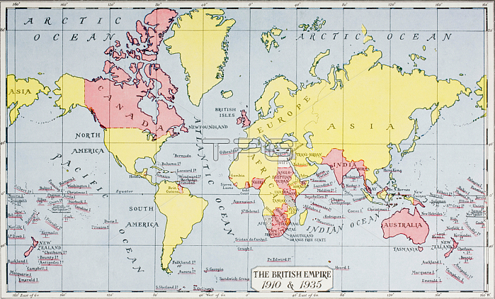
1772344 Map showing the King\'s empire, in red, in 1910 and 1935, from \'The Queen, The Lady\'s Newspaper\', published 1935 (colour litho) by English School, (20th century); Private Collection; (add.info.: British owned islands in 1910 shown with one red line. There were no additions to the British Empire by 1935, with the exception of sundry islands, which are shown with two red lines.); Photo 穢 Hilary Morgan; English, out of copyright.
| px | px | dpi | = | cm | x | cm | = | MB |
Details
Creative#:
TOP27425132
Source:
達志影像
Authorization Type:
RM
Release Information:
須由TPG 完整授權
Model Release:
No
Property Release:
No
Right to Privacy:
No
Same folder images:
1930s30sthirties1930\'s1930-193920thcentury20centuryXXcenturyXXthcenturytwentiethcentury2020thxxxxthtwentiethcentury2020thxxxxthcentury2020th20thXXXXth20thcenturyc20th30sthirtiesruleedwardiangeographicalcolonyempirediagrammapmakinghistoricalcoloniescolonialismimperialworldbritainbritish1900s1910smapgeographycolonialpowercolonisationkinghistory19101935thirtiesruleedwardiangeographicalcolonyempirediagrammapmakinghistoricalcoloniescolonialismimperialworldbritainbritish1930s1900s1910smapgeographycolonialpowercolonisationkinghistory19101935
1900s1900s191019101910s1910s1930-19391930\'s1930s1930s202020201935193520th20th20th20th20th20th30s30sXXXXXXthXXthbritainbritainbritishbritishc20thcenturycenturycenturycenturycenturycenturycenturycenturycolonialcolonialcolonialismcolonialismcoloniescoloniescolonisationcolonisationcolonycolonydiagramdiagramedwardianedwardianempireempiregeographicalgeographicalgeographygeographyhistoricalhistoricalhistoryhistoryimperialimperialkingkingmapmapmapmakingmapmakingpowerpowerrulerulethirtiesthirtiesthirtiestwentiethtwentiethworldworldxxxxxxthxxth

 Loading