
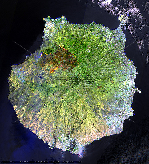
Wildfire on Gran Canaria, infrared satellite image. The fires (orange) are at upper left, with the burnt areas visible in dark brown. This wildfire started on 17 August 2019, and affected over 10,000 hectares of land. This image, dating from 19 August, was produced with the shortwave infrared sensor from one of the Copernicus Sentinel-2 satellites. Gran Canaria is part of Spain's Canary Islands.
| px | px | dpi | = | cm | x | cm | = | MB |
Details
Creative#:
TOP27285918
Source:
達志影像
Authorization Type:
RM
Release Information:
須由TPG 完整授權
Model Release:
N/A
Property Release:
N/A
Right to Privacy:
No
Same folder images:
 Loading