
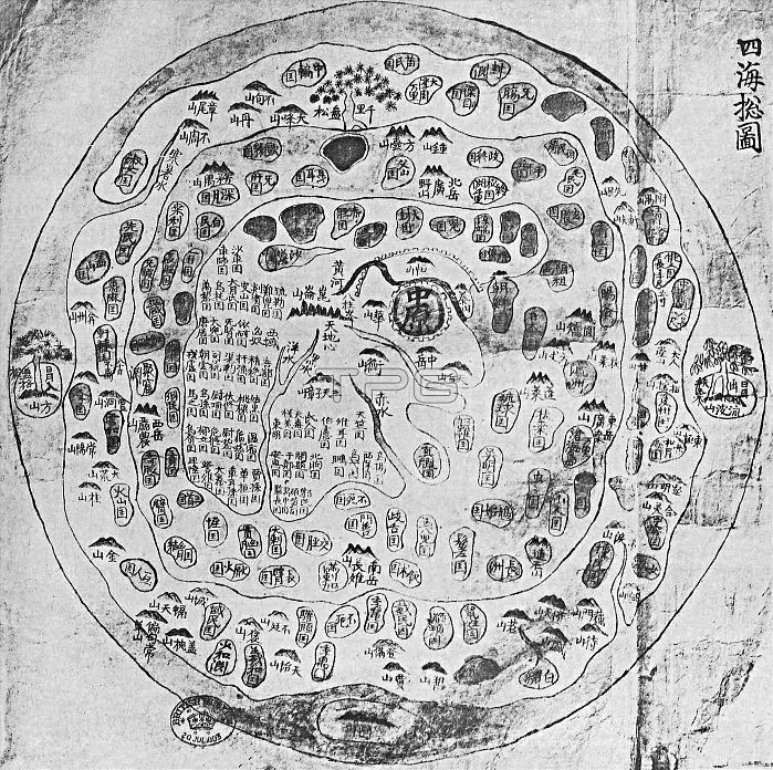
This Chonhado (map of all under heaven), was produced in Korea in the 17th century. The map comes out of the Buddhist tradition of China with data possibly 2000 years old, although the earliest-known surviving examples date from the sixteenth century. From that time, the style gained popularity in Korea, and by the end of the nineteenth century numerous copies existed. The structure of the map is simple. A main continent, containing China, Korea, and a number of historically known countries, occupies the center of the circular map, surrounded by an enclosing sea ring, which is itself surrounded by an outerring of land.
| px | px | dpi | = | cm | x | cm | = | MB |
Details
Creative#:
TOP27178129
Source:
達志影像
Authorization Type:
RM
Release Information:
須由TPG 完整授權
Model Release:
No
Property Release:
No
Right to Privacy:
No
Same folder images:
 Loading