
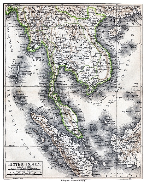
Physical map showing approximate political frontiers in Green. The Shan and Lao states are shown independent of (or tributary to) Siam. Chiang Mai ('Tshien-Mai'and Luang Prabang are both shown lying within the frontiers of a greater Siam,, but the territoryy of Chiang Mai extends further to the northwest, into Burma's Shan State, beyond the Salween River, than it does today. Cambodia is much curtailed, with Angkor and Battambang part of Siam. Champa is still indicated in southern Vietnam ('Tshampa'), though it finally ceased to exist in 1832. The Lao kingdoms of Luang Prabang, Vientiane (Vien Tscan) and Champassak are all represented as part of Greater Siam. The Anglo-French competition for dominion over the region was just starting, and over the next 30 years Siam would lose much of its territory to the east and Northeast, as well as in the Malayan Peninsula.
| px | px | dpi | = | cm | x | cm | = | MB |
Details
Creative#:
TOP27177474
Source:
達志影像
Authorization Type:
RM
Release Information:
須由TPG 完整授權
Model Release:
No
Property Release:
No
Right to Privacy:
No
Same folder images:
 Loading