
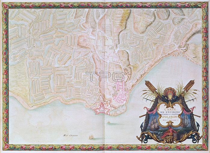
694797 Ms. 988 T. III fol. 42 Map of the environs of the town and castle of Ol矇ron, from the Atlas of Louis XIV (pen, ink and gouache on paper) by Vauban, Sebastien Le Prestre de (1633-1707); Bibliotheque du Genie, Paris, France; (add.info.: island in the Atlantic off the western coast of France; the star defence design of the fortifications of the citadel of the castle are typical of the many similar designs of Vauban, the foremost military engineer of the 17th century; the island has a significant place in maritime legal history because Queen El矇anor of Aquitaine (1122-1204) promulgated here the Rolls of Ol矇ron (R繫les d\'Ol矇ron, also known as the "Judgments of Oleron" and the "Rules of Ol矇ron") the first formal statement of "maritime" or "admiralty" laws in northwestern Europe;).
| px | px | dpi | = | cm | x | cm | = | MB |
Details
Creative#:
TOP27147184
Source:
達志影像
Authorization Type:
RM
Release Information:
須由TPG 完整授權
Model Release:
No
Property Release:
No
Right to Privacy:
No
Same folder images:
 Loading