
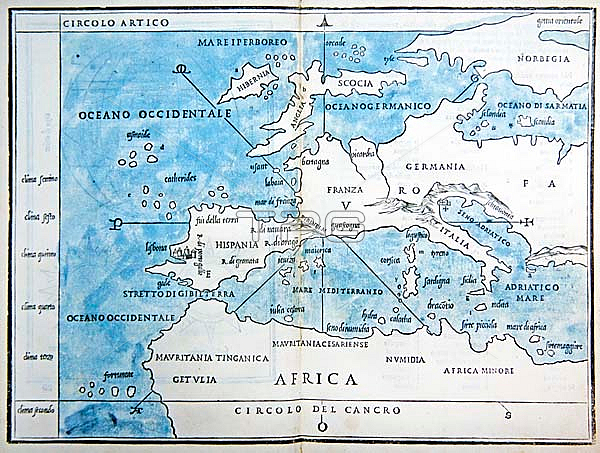
694842 Map of Europe and North Africa, 1528 (engraving with wash)) by Bordone, Benedetto (c.1450-1530); Private Collection; (add.info.: One of the earliest printed maps of Europe, from the \'Isolario (\'Book of Islands\') of Bordone, printed by Nicolo d\'Aristotile and published in Venice. \'Isolario di Benedetto Bordone nel qual si ragiona di tutte l\'isole del mondo, con li lor nomi antichi &??moderni, historie, fauole, &??modi del loro viuere &??in qual parte del mare stanno, &??in qual parallelo &??clima giacion\'. Intended as an illustrated guide for sailors and included all the known new discoveries.).
| px | px | dpi | = | cm | x | cm | = | MB |
Details
Creative#:
TOP27142500
Source:
達志影像
Authorization Type:
RM
Release Information:
須由TPG 完整授權
Model Release:
No
Property Release:
No
Right to Privacy:
No
Same folder images:
 Loading