
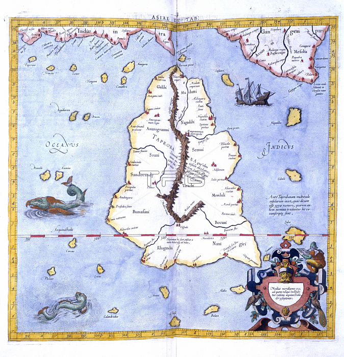
702373 The Island of Taprobane, from Mercator\'s edition of Ptolemy\'s \'Geography\' entitled \'Universalis tabula iuxta Ptolemeum\', 1578 (colour litho) by Mercator, Gerardus (1512-94); Royal Geographical Society, London, UK; 穢 Royal Geographical Society ; Flemish, out of copyright.
| px | px | dpi | = | cm | x | cm | = | MB |
Details
Creative#:
TOP27138570
Source:
達志影像
Authorization Type:
RM
Release Information:
須由TPG 完整授權
Model Release:
No
Property Release:
No
Right to Privacy:
No
Same folder images:
cartographyasianortherneditionptolemyasianindianmapsoceanislandmapgeographyuniversalistabulaiuxtaptolemeumptolemy\'slankaceylonsrimercator\'staprobanesrilankamercatorasianortherneditionptolemyasianindianmapsoceanislandmapgeographyuniversalistabulaiuxtaptolemeumptolemy'slankaceylonsrimercator'staprobanesrilankamercator
asiaasiaasianasiancartographyceylonceyloneditioneditiongeographygeographyindianindianislandislandiuxtaiuxtalankalankalankalankamapmapmapsmapsmercatormercatormercator'smercator\'snorthernnorthernoceanoceanptolemeumptolemeumptolemyptolemyptolemy'sptolemy\'ssrisrisrisritabulatabulataprobanetaprobaneuniversalisuniversalis
 Loading