
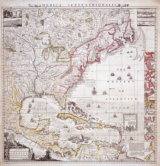
619432 A Map of the British Empire in America with the French settlements adjacent thereto, engraved by William Henry Toms (c.1700-58), c.1733 (hand-coloured engraving) by Popple, Henry (d.1743); Private Collection; The Stapleton Collection; British, out of copyright.
| px | px | dpi | = | cm | x | cm | = | MB |
Details
Creative#:
TOP27116538
Source:
達志影像
Authorization Type:
RM
Release Information:
須由TPG 完整授權
Model Release:
No
Property Release:
No
Right to Privacy:
No
Same folder images:
CaribbeanCarribeancartographysettlementsnewenglandcaribbeandiscoverybritishempirefrenchcontinentexplorationcolonialismmapscontinentsmapcolonialatlasesamericanamericanewfrancecartographicatlaswilliamhenrytomsamericasEngravingMzengravingsettlementsnewenglandcaribbeandiscoverybritishempirefrenchcontinentexplorationcolonialismmapscontinentsmapcolonialatlasesamericanamericanewfrancecartographicatlaswilliamhenrytomsamericas
CaribbeanCarribeanEngravingMzengravingamericaamericaamericanamericanamericasamericasatlasatlasatlasesatlasesbritishbritishcaribbeancaribbeancartographiccartographiccartographycolonialcolonialcolonialismcolonialismcontinentcontinentcontinentscontinentsdiscoverydiscoveryempireempireenglandenglandexplorationexplorationfrancefrancefrenchfrenchhenryhenrymapmapmapsmapsnewnewnewnewsettlementssettlementstomstomswilliamwilliam
 Loading