
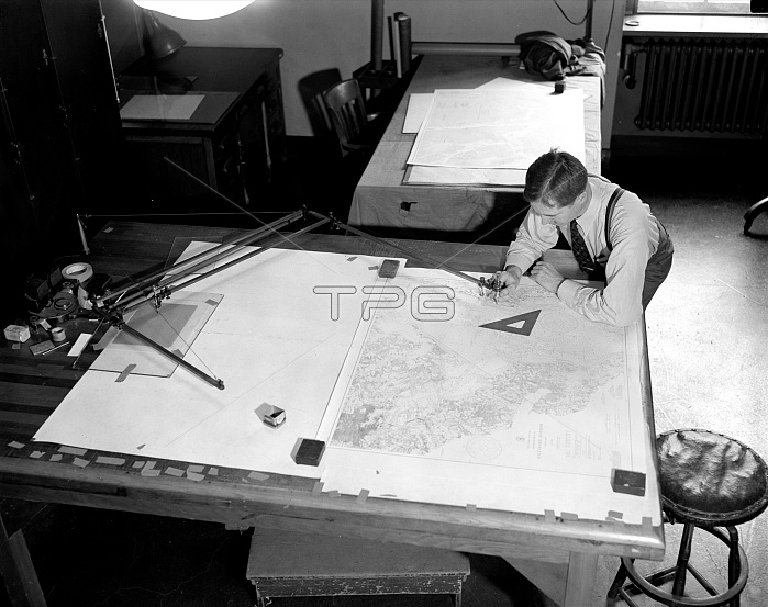
Map-making Division of Coast & Geodetic Survey, Dept of Commerce, cartographer in process of making a map circa 1940 .
| px | px | dpi | = | cm | x | cm | = | MB |
Details
Creative#:
TOP27010407
Source:
達志影像
Authorization Type:
RM
Release Information:
須由TPG 完整授權
Model Release:
No
Property Release:
No
Right to Privacy:
No
Same folder images:
archivalhistoricalvintagehistoryearly20thcenturyimagesearly20thcenturyphotosearly1900snewsphotoearly1900snewsphotosearly20thcenturynewsphotoearly20thcenturynewsimagescartographermapmakingmapmaker1940scatographercartographyhistoricalcartographyhistoricalcartographerhistoricalmapmakinghistoricalmapmakerarchivalmapmakerarchivalmapmakingvintagemapmakermapmakin
1900s1900s1940s20th20th20th20tharchivalarchivalarchivalcartographercartographercartographycartographycatographercenturycenturycenturycenturyearlyearlyearlyearlyearlyearlyhistoricalhistoricalhistoricalhistoricalhistoricalhistoryimagesimagesmakermakermakermakermakinmakingmakingmakingmapmapmapmapmapmapmapmapnewsnewsnewsnewsphotophotophotosphotosvintagevintage
 Loading