
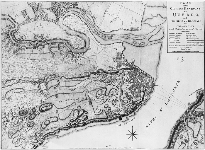
XIR287502 Ms A 224 f.8 Map of the city and environs of Quebec with its siege and blockade by the Americans, illustration from the \'Atlas de la guerre d\'Amerique\', 1775-76) (engraving) (b/w photo) by English School, (18th century); Service Historique de L\'Armee et de L\'Air, Vincennes, France; (add.info.: map of the siege and blockade of Quebec by the Americans;); English, out of copyright.
| px | px | dpi | = | cm | x | cm | = | MB |
Details
Creative#:
TOP26983230
Source:
達志影像
Authorization Type:
RM
Release Information:
須由TPG 完整授權
Model Release:
No
Property Release:
No
Right to Privacy:
No
Same folder images:
 Loading