
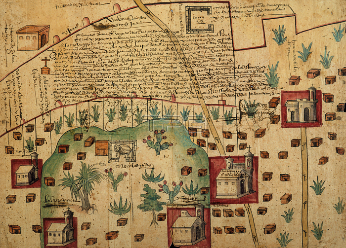
NBY259416 Ayer MS 1801 Map 1: Map of lands in the Tultepec and Jaltocan regions adjacent to the Hacienda de Santa Ines, Mexico, published 1569 (colour litho) by Spanish School, (16th century); Newberry Library, Chicago, Illinois, USA; (add.info.: shows lands between Lake Zumpango and Lake Jaltocan south of the Santa Ines Hacienda (roughly 20 miles north of Mexico City); combines Indian and European symbols to identify five churches, two roads, two sheep corrals, numerous Indian houses, fields, and various boundary lines;); 穢 Newberry Library ; Spanish, out of copyright.
| px | px | dpi | = | cm | x | cm | = | MB |
Details
Creative#:
TOP26971812
Source:
達志影像
Authorization Type:
RM
Release Information:
須由TPG 完整授權
Model Release:
No
Property Release:
No
Right to Privacy:
No
Same folder images:
 Loading