
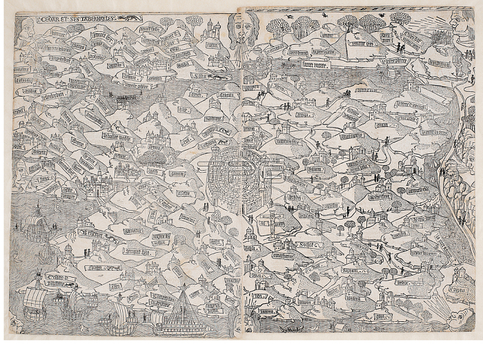
IMJ383357 Map of the Holy Land, from \'La mer des hystoires\' by Vincent Commin, 1488 (woodcut) by Le Rouge, Pierre (fl. late 15th century); 38.7x55.2 cm; The Israel Museum, Jerusalem, Israel; (add.info.: after Lucas Bandis de Schass;); 穢 Israel Museum, Jerusalem ; Gift of Norman and Frieda Bier; French, out of copyright.
| px | px | dpi | = | cm | x | cm | = | MB |
Details
Creative#:
TOP26919289
Source:
達志影像
Authorization Type:
RM
Release Information:
須由TPG 完整授權
Model Release:
No
Property Release:
No
Right to Privacy:
No
Same folder images:
coastcoastlineshorelineseamaritimecartographytopographicalshipscitygeographicaldrawingjerusalemtopographypromisedlandmappinggeographymountainsillustratedmonochromeplantopographicalshipscitygeographicaldrawingjerusalemtopographypromisedlandmappinggeographymountainsillustratedmonochromecoastalcoastplan
cartographycitycitycoastcoastcoastalcoastlinedrawingdrawinggeographicalgeographicalgeographygeographyillustratedillustratedjerusalemjerusalemlandlandmappingmappingmaritimemonochromemonochromemountainsmountainsplanplanpromisedpromisedseashipsshipsshorelinetopographicaltopographicaltopographytopography
 Loading