
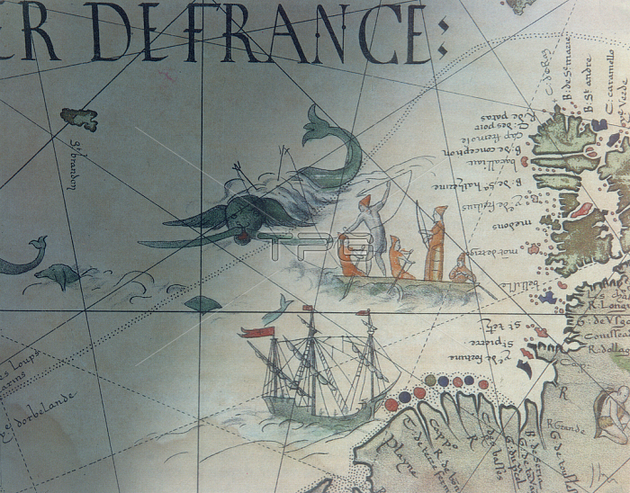
CHT163010 Facsmile of Whaling and Isle of Saint Brandon, detail from a portolan map by Pierre Desceliers, 1546, published in \'Monuments de la Geographie\' by Edme Francois Jomard (1777-1862) (coloured engraving) by French School, (19th century); Private Collection; (add.info.: Mappemonde faictes a? Arques par Pierre Desceliers presbre 1546; Mappemonde peintre sur parchemin par ordre de Henri II, Roi de France; Pierre Desceliers, priest and cartographer (c.1500-c.1558) of the Dieppe school of Cartography; the map on vellum was made for King Henri II of France; Chasse a la baleine et Ile de Saint-Brandon;); 穢 Archives Charmet; French, out of copyright.
| px | px | dpi | = | cm | x | cm | = | MB |
Details
Creative#:
TOP26904837
Source:
達志影像
Authorization Type:
RM
Release Information:
須由TPG 完整授權
Model Release:
No
Property Release:
No
Right to Privacy:
No
Same folder images:
 Loading