
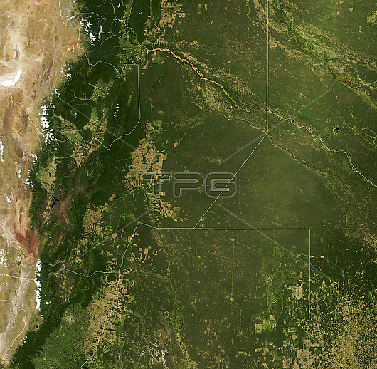
Satellite image showing areas of deforestation (brown) in the Argentinian Gran Chaco forest. The area shown is in Argentina's Salta province. The forest, which spans Argentina, Brazil, Paraguay and Bolivia, is the largest dry forest in South America at approximately 650,000 square kilometres. The land is being cleared for soybean fields and pastures for grazing livestock. Between 1985 and 2013 roughly 20 per cent of the forest (142,000 square kilometres) was converted to farmland, followed by a further 29,000 square kilometres from 2010 to 2018. This is a view of the area on the 18th December 2000. For a view of the area in 2019 see C052/6173. Image obtained by the Moderate Resolution Imaging Spectroradiometer (MODIS) on NASA's Terra satellite.
| px | px | dpi | = | cm | x | cm | = | MB |
Details
Creative#:
TOP26624153
Source:
達志影像
Authorization Type:
RM
Release Information:
須由TPG 完整授權
Model Release:
N/A
Property Release:
N/A
Right to Privacy:
No
Same folder images:
 Loading