
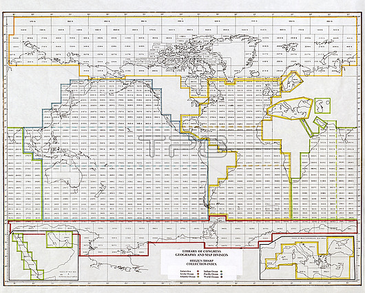
Ocean floor world map index, 20th century. This map forms an index to work on mapping ocean floors that was carried out by the Lamont-Doherty Earth Science Observatory of Columbia University, New York, USA. This work was co-ordinated by US geologist Bruce C. Heezen (1924-1977) and US oceanographic cartographer Marie Tharp (1920-2006). The key at lower centre colour-codes the map divisions into six sections: Antarctica, Arctic Ocean, Atlantic Ocean, Indian Ocean, Pacific Ocean and World Oceans. The two insets in the lower left and lower right corners are for the Red Sea and Persian Gulf (left) and the Mediterranean Sea (right).
| px | px | dpi | = | cm | x | cm | = | MB |
Details
Creative#:
TOP26515764
Source:
達志影像
Authorization Type:
RM
Release Information:
須由TPG 完整授權
Model Release:
N/A
Property Release:
N/A
Right to Privacy:
No
Same folder images:
 Loading