
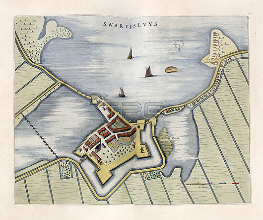
Fort Swartesluys, 17th century. This fort is part of what is now the city of Zwartsluis in the province of Overijssel in the Netherlands. This fort controlled traffic on the Zwartewater inlet leading to Hasselt and Zwolle. During the Dutch Golden Age that peaked in the 17th century, the Dutch had a strong standing field army with garrisons in the numerous fortified cities across the country. This map is from 'Toonneel der steden van de Vereenighde Nederlanden' (1652), an atlas of maps of the cities and towns of the United Provinces of the Netherlands, published by Dutch cartographer Joan Blau (1596-1673).
| px | px | dpi | = | cm | x | cm | = | MB |
Details
Creative#:
TOP26515751
Source:
達志影像
Authorization Type:
RM
Release Information:
須由TPG 完整授權
Model Release:
N/A
Property Release:
N/A
Right to Privacy:
No
Same folder images:
 Loading