
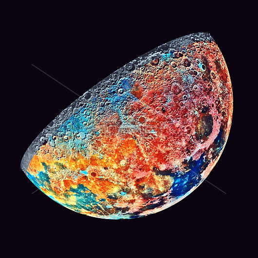
False-colour map of the Moon's northern hemisphere showing surface soil compositions. Pink areas are upland formations, such as the ring around the Mare Crisium impact basin at centre right. Dark blue areas are titanium-rich basalts, the largest of these is the Sea of Tranquility at bottom right. Orange ares are titanium-poor basalts. Pale blue colours represent thin, mineral rich soils from relatively recent impacts. The data for this image were gathered by the Galileo spacecraft on 7th December 1992 during its second gravity-assist flyby of Earth. Galileo's final destination is the planet Jupiter.
| px | px | dpi | = | cm | x | cm | = | MB |
Details
Creative#:
TOP25967568
Source:
達志影像
Authorization Type:
RM
Release Information:
須由TPG 完整授權
Model Release:
N/A
Property Release:
N/A
Right to Privacy:
No
Same folder images:
 Loading