
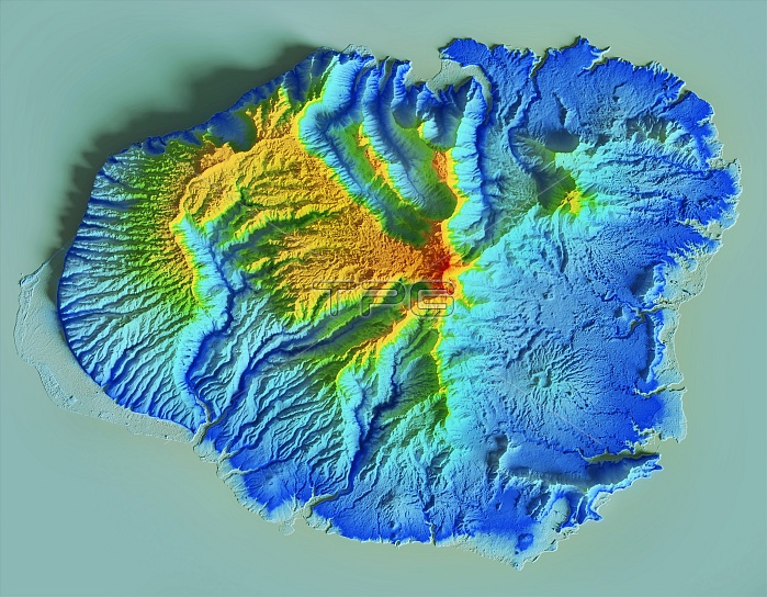
Hawaiian island of Kauai, LiDAR satellite image. Geologically, this is the oldest of the Hawaiian island, with the volcanic peak classified as extinct. The peak (red) reaches an elevation of 1598 metres. LiDAR combines optical and laser imaging to produce digital elevation maps (DEMs), with differences in elevation shown by the colour-coding of the image. Image data obtained by the radar and optical sensors on the Advanced Land Observation Satellite (ALOS) of the Japan Aerospace Exploration Agency (JAXA).
| px | px | dpi | = | cm | x | cm | = | MB |
Details
Creative#:
TOP25469167
Source:
達志影像
Authorization Type:
RM
Release Information:
須由TPG 完整授權
Model Release:
N/A
Property Release:
N/A
Right to Privacy:
No
Same folder images:
 Loading