
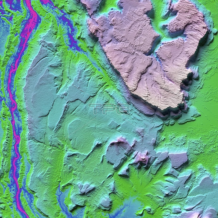
Canaima National Park in Venezuala, LiDAR satellite image. This area of Venezuala is famous for its tepui, table-top mountains or mesas, rising vertically from the surrounding Guiana Highlands of South America. A tepui is at upper right (pink), with a river at left. LiDAR combines optical and laser imaging to produce digital elevation maps (DEMs), with differences in elevation shown by the colour-coding of the image. Image data obtained by the radar and optical sensors on the Advanced Land Observation Satellite (ALOS) of the Japan Aerospace Exploration Agency (JAXA).
| px | px | dpi | = | cm | x | cm | = | MB |
Details
Creative#:
TOP25469163
Source:
達志影像
Authorization Type:
RM
Release Information:
須由TPG 完整授權
Model Release:
N/A
Property Release:
N/A
Right to Privacy:
No
Same folder images:
ADVANCEDLANDOBSERVATIONSATELLITEGEOGRAPHICALJAPANAEROSPACEEXPLORATIONAGENCYNO-ONENOBODYDIGITALELEVATIONMAPDEMSOUTHAMERICANLATINAMERICATABLE-TOPMOUNTAINMESASGEOLOGICALTEPUIRIVERHIGHLANDMESACANAIMANATIONALPARKGUIANAHIGHLANDSVENEZUELASOUTHAMERICAEARTHOBSERVATIONGEOGRAPHYGEOLOGYSATELLITEIMAGEFROMSPACEALOSJAXA
ADVANCEDAEROSPACEAGENCYALOSAMERICAAMERICAAMERICANDEMDIGITALEARTHELEVATIONEXPLORATIONFROMGEOGRAPHICALGEOGRAPHYGEOLOGICALGEOLOGYGUIANAHIGHLANDHIGHLANDSIMAGEJAPANJAXALANDLATINMAPMESACANAIMAMESASMOUNTAINNATIONALNO-ONENOBODYOBSERVATIONOBSERVATIONPARKRIVERSATELLITESATELLITESOUTHSOUTHSPACETABLE-TOPTEPUIVENEZUELA
 Loading