
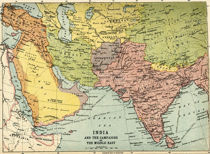
'India and the Campaigns of the Middle East', First World War, 1914-1918, (c1920). Map showing British India coloured pink as part of the British Empire, Afghanistan, Persia, Asia Minor, Arabia, the Arabian Sea and the Bay of Bengal. From "The Great World War: A History", Volume V, edited by Frank A Mumby. [The Gresham Publishing Company Ltd, London, c1920]
| px | px | dpi | = | cm | x | cm | = | MB |
Details
Creative#:
TOP25460374
Source:
達志影像
Authorization Type:
RM
Release Information:
須由TPG 完整授權
Model Release:
No
Property Release:
No
Right to Privacy:
No
Same folder images:
IndianOceancoastIndiacoastalMiddleEastcountrybookTurkeycolorTurkishwarlocationcenturyfirstworldwarTibetconceptColourKazakhstanArabiaWorldWarIWWIArabianSeaAfghanistanPersiaWorldWarOne1910s20thcenturyAsiaMinorThePrintCollector1stWorldWarBayofBengalBritishEmpireBritishRajimperialismRajTGNWW1TurkestanmapTheRajKeystoneArchivesBritishIndiaTheGreatWorldWar:AHistoryFrankArthurMumbyMumbyFrankArthurGreshamPublishingCompanyGreshamPublishingCoLtdJohnBartholomew&SonBartholomewJohn&SonBartholomew&CoJohnBartholomew&CoJ.G.BartholomewJohnBartholomew&SonLtdFrankAMumbyFrankA.MumbyFrankA.FrankA
&&&&&1910s1st20thAAAA.A.AfghanistanArabiaArabianArchivesArthurArthurAsiaBartholomewBartholomewBartholomewBartholomewBartholomewBartholomewBayBengalBritishBritishBritishCoCoCoCollectorColourCompanyEastEmpireFrankFrankFrankFrankFrankFrankGreatGreshamGreshamHistoryIIndiaIndiaIndianJ.G.JohnJohnJohnJohnKazakhstanKeystoneLtdLtdMiddleMinorMumbyMumbyMumbyMumbyOceanOnePersiaPrintPublishingPublishingRajRajRajSeaSonSonSonTGNTheTheTheTibetTurkestanTurkeyTurkishWW1WWIWarWarWarWar:WorldWorldWorldWorldbookcenturycenturycoastcoastalcolorconceptcountryfirstimperialismlocationmapofwarwarworld
 Loading